Coming soon
We are putting the finishing touches on this course so you can make the most of it. If you like, we will let you know as soon as it is available.
Estimated time: 2 hours
Language: Spanish
Date: 2026
Format: online, self-paced
Code: RGNAGT8001
Intended for: professionals, technicians and students in the agricultural, forestry and environmental sectors interested in using drones, remote sensors and artificial intelligence to monitor and manage production systems and natural resources.
Description:
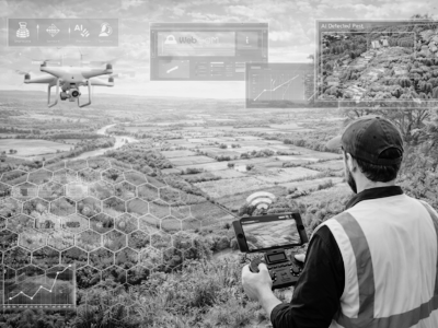
This course introduces the use of drones (UAVs) and remote sensors as key tools for precision agriculture and natural resource assessment. It covers the fundamentals of drone technology, flight planning, the principles of photogrammetry and LiDAR, and data processing with tools such as WebODM. It also explores real applications in environmental, forestry and agricultural monitoring, as well as the use of artificial intelligence and computer vision for object and pest detection. The course aims to provide a practical, applied view so you can integrate these innovative technologies into decision-making for more efficient and resilient ecosystem management.
Learning outcomes:
By the end of this course, you should be able to:
- Identify the main types of drones, sensors and resolutions used in agricultural and environmental monitoring, recognizing their features and field applications.
- Understand the fundamentals of flight planning, photogrammetry and elevation models for generating geospatial information from drone imagery.
- Apply basic data processing and image analysis tools (such as WebODM and computer vision techniques) to support the assessment of natural resources and production systems.
Instructor: